Patent Figure Sheet - folio-pin
Geospatial Trade Mapping & Circular Economy Platform
PATENT APPLICATION FIGURES
FOLIO-PIN: Geospatial Trade Documentation and Local Circular Economy Platform
Provisional Patent Application - April 2026
7 Figures Enclosed · Patent Pending
FIG. 1 - GEOSPATIAL TRADE MAPPING INTERFACE
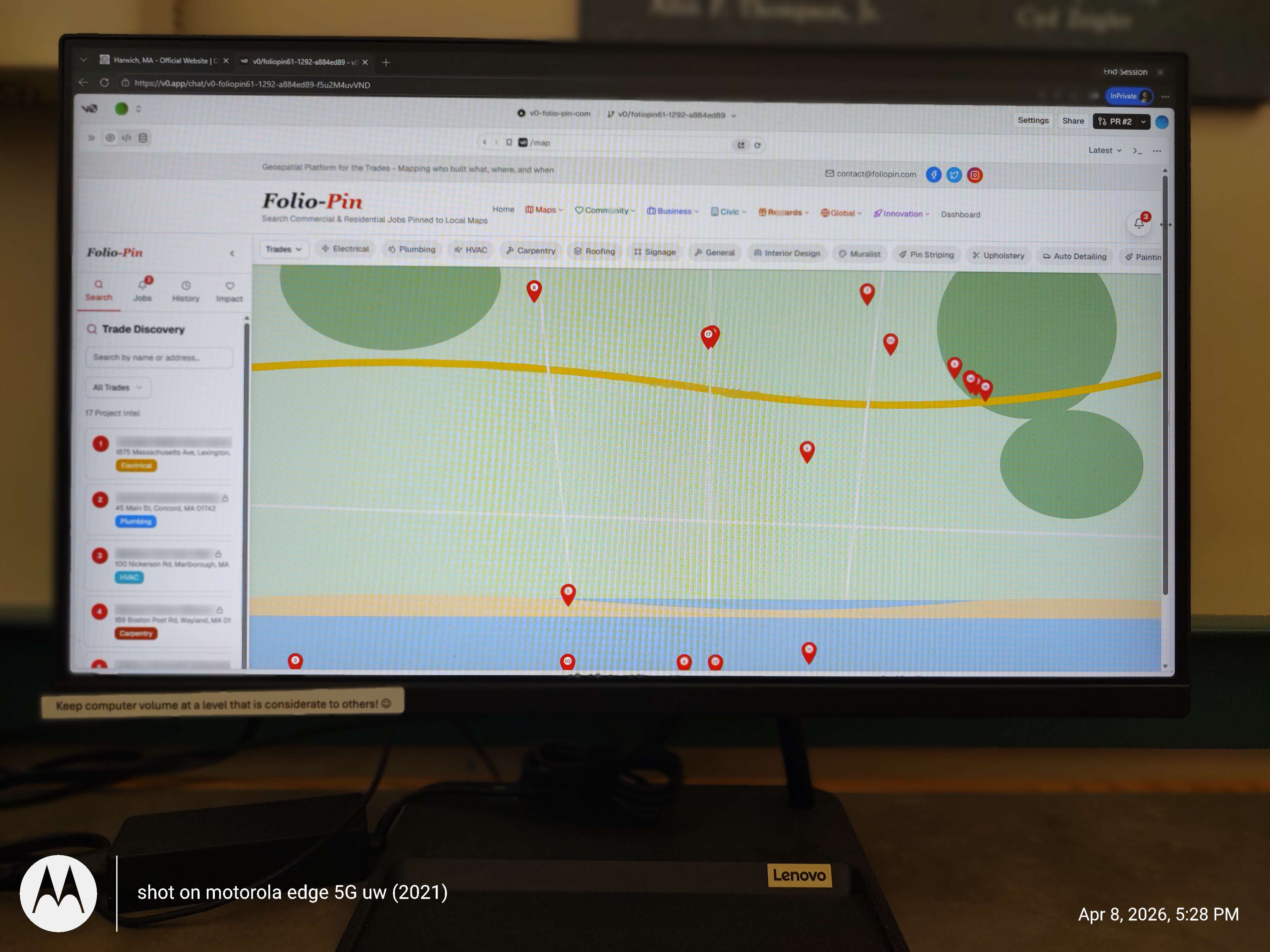
Fig. 1 illustrates the geospatial trade mapping interface showing: (A) interactive map with location pins representing completed trade work; (B) trade category filters including Electrical, Plumbing, HVAC, Carpentry, Roofing, Signage, and additional specialties; (C) search panel with Trade Discovery functionality allowing search by name or address; (D) job listing results with location addresses and trade type badges; (E) colored service coverage zones indicating contractor operating areas.
FIG. 2 - CIRCULAR ECONOMY CREDIT SYSTEM

Fig. 2 illustrates the circular economy rewards system showing: (A) user credit balance display (2,450 Community Credits); (B) tiered membership level (Gold Pioneer) with progress tracking to next tier (72% to Platinum Steward); (C) engagement metrics including day streak, community rank, and lifetime credits; (D) platform-wide impact statistics showing active members (12,450), total credits earned (2.4M), materials recycled (18.2 tons), and community value ($127k).
FIG. 3 - 100-YEAR PROPERTY ASSET TIMELINE
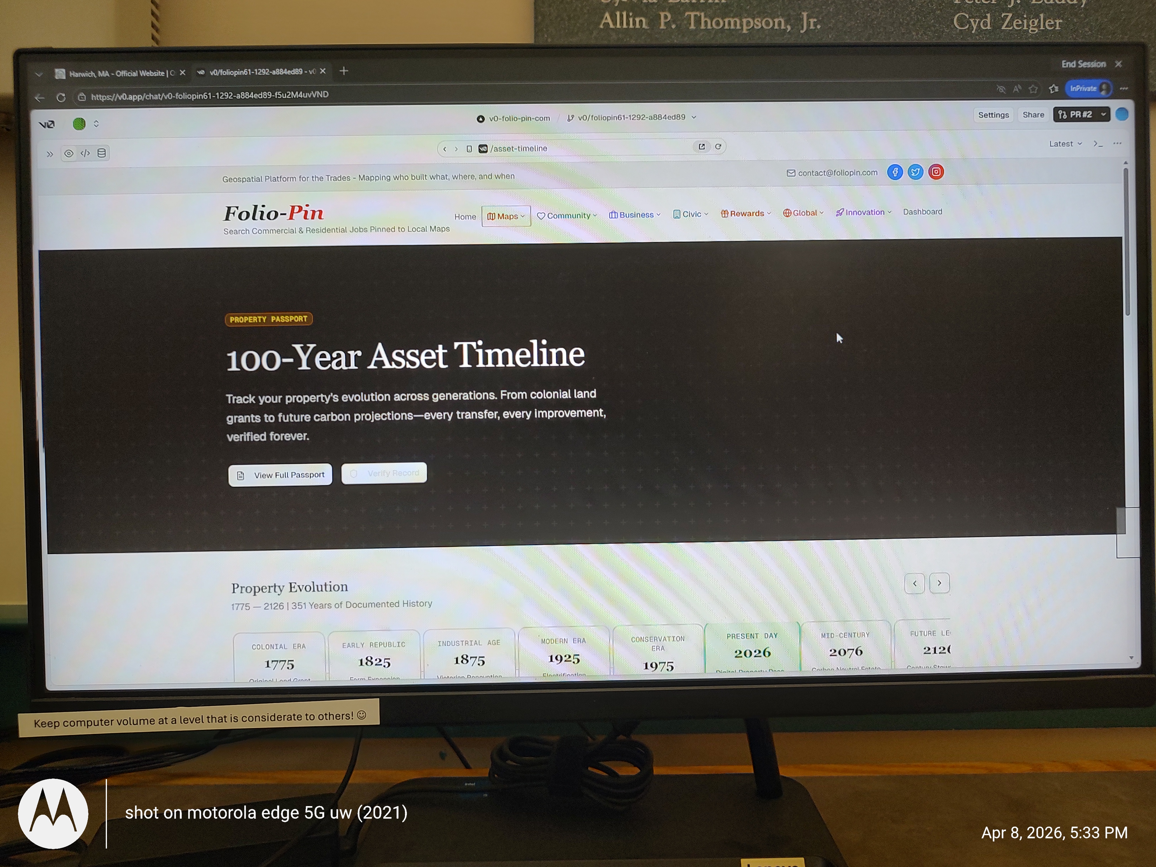
Fig. 3 illustrates the 100-Year Asset Timeline (Property Passport) showing: (A) property documentation spanning 351 years of recorded history (1775-2126); (B) era-based timeline markers including Colonial Era (1775), Early Republic (1825), Industrial Age (1875), Modern Era (1925), Conservation Era (1975), Present Day (2026), Mid-Century projections (2076), and Future projections (2126); (C) permanent verification system for property transfers and improvements.
FIG. 4 - AGRICULTURAL & RURAL COMMUNITY EXTENSION
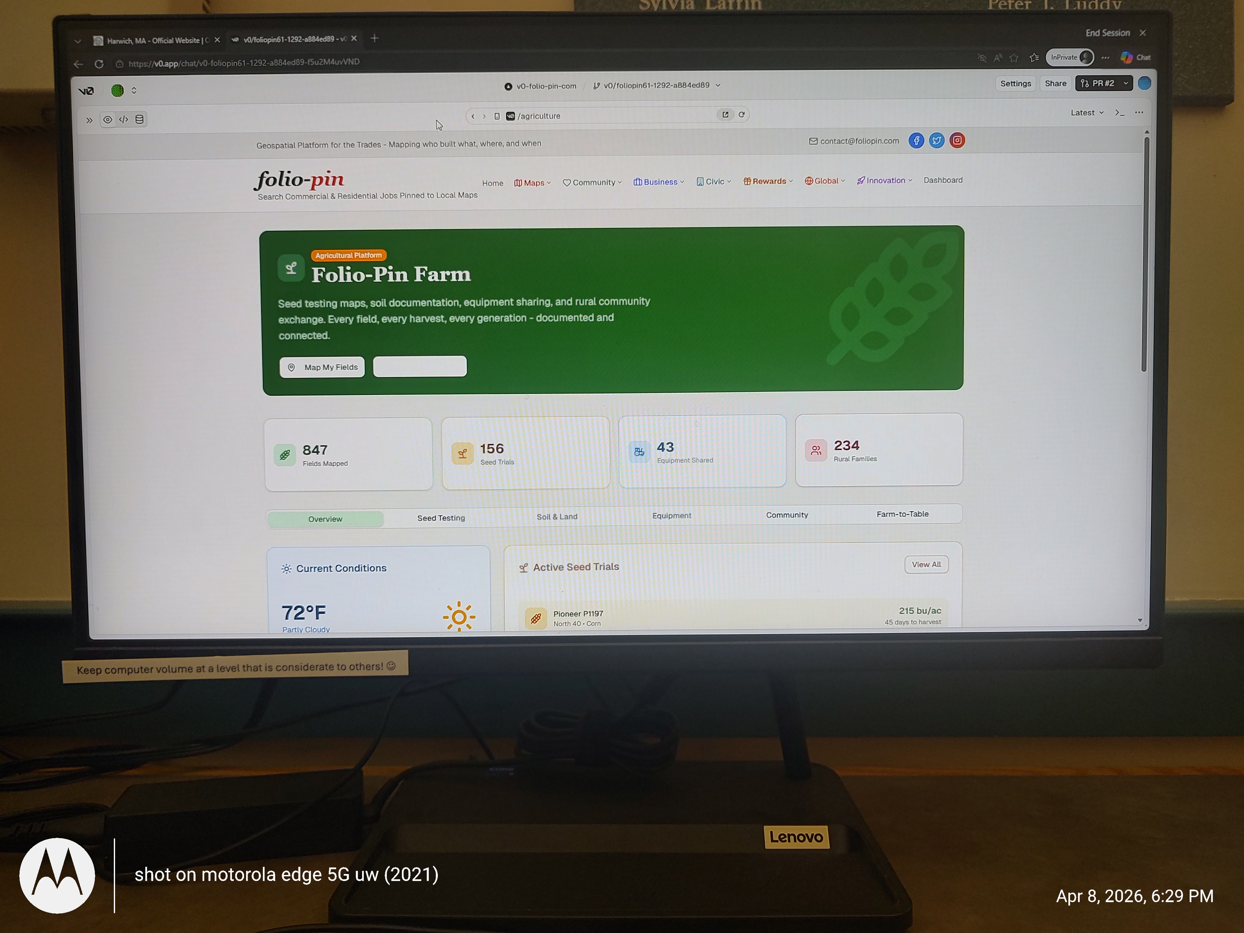
Fig. 4 illustrates the agricultural platform extension showing: (A) Folio-Pin Farm dashboard with seed testing maps, soil documentation, and equipment sharing functions; (B) platform statistics including Fields Mapped (847), Seed Trials (156), Equipment Shared (43), and Rural Families served (234); (C) tabbed interface for Overview, Seed Testing, Soil & Land, Equipment, Community, and Farm-to-Table features; (D) real-time conditions display and active seed trial tracking with yield data.
FIG. 5 - COMMERCIAL & RESIDENTIAL MATERIAL COLLECTION SYSTEM
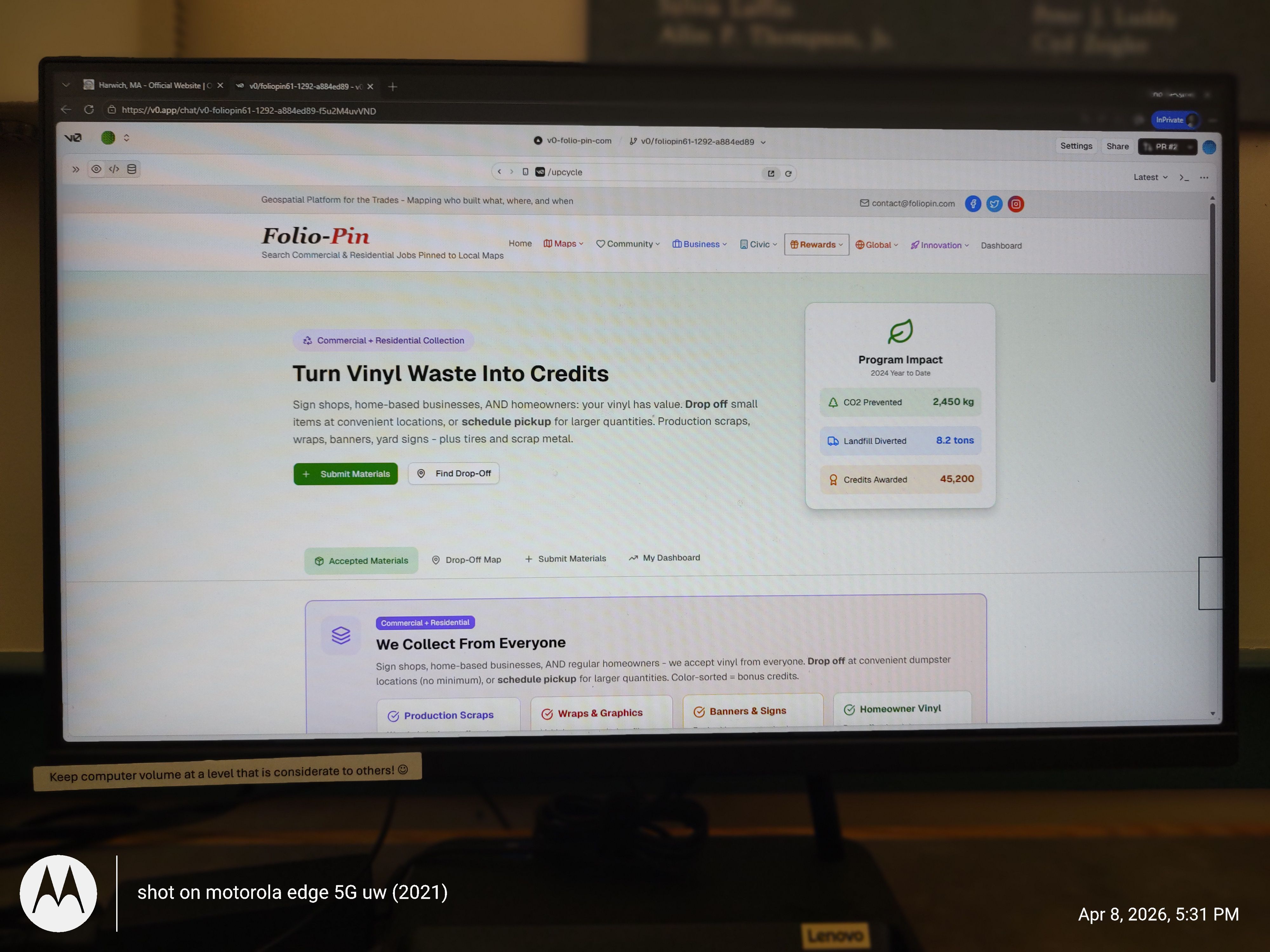
Fig. 5 illustrates the upcycle material collection system showing: (A) vinyl waste-to-credits conversion for sign shops, home-based businesses, and homeowners; (B) Program Impact metrics including CO2 Prevented (2,450 kg), Landfill Diverted (8.2 tons), and Credits Awarded (45,200); (C) material submission and drop-off location finder; (D) accepted material categories including Production Scraps, Wraps & Graphics, Banners & Signs, and Homeowner Vinyl with color-sorting bonus credits.
FIG. 6 - TWO-SIDED MARKETPLACE BUSINESS MODEL

Fig. 6 illustrates the investor presentation showing the two-sided marketplace business model: (A) platform overview mapping commercial and residential trade work to local maps creating searchable records of who built what, where, and when; (B) built-in circular economy enabling credit-based transactions; (C) market opportunity addressing the $1.8 trillion home services market with 10,000+ trade categories; (D) revenue model including Pro subscriptions, transaction fees, advertising, and data licensing; (E) community-driven growth strategy connecting tradespeople, property owners, and local businesses.
FIG. 7 - LoRa RADIO/CELLULAR HYBRID CHILD LOCATOR HARDWARE SYSTEM
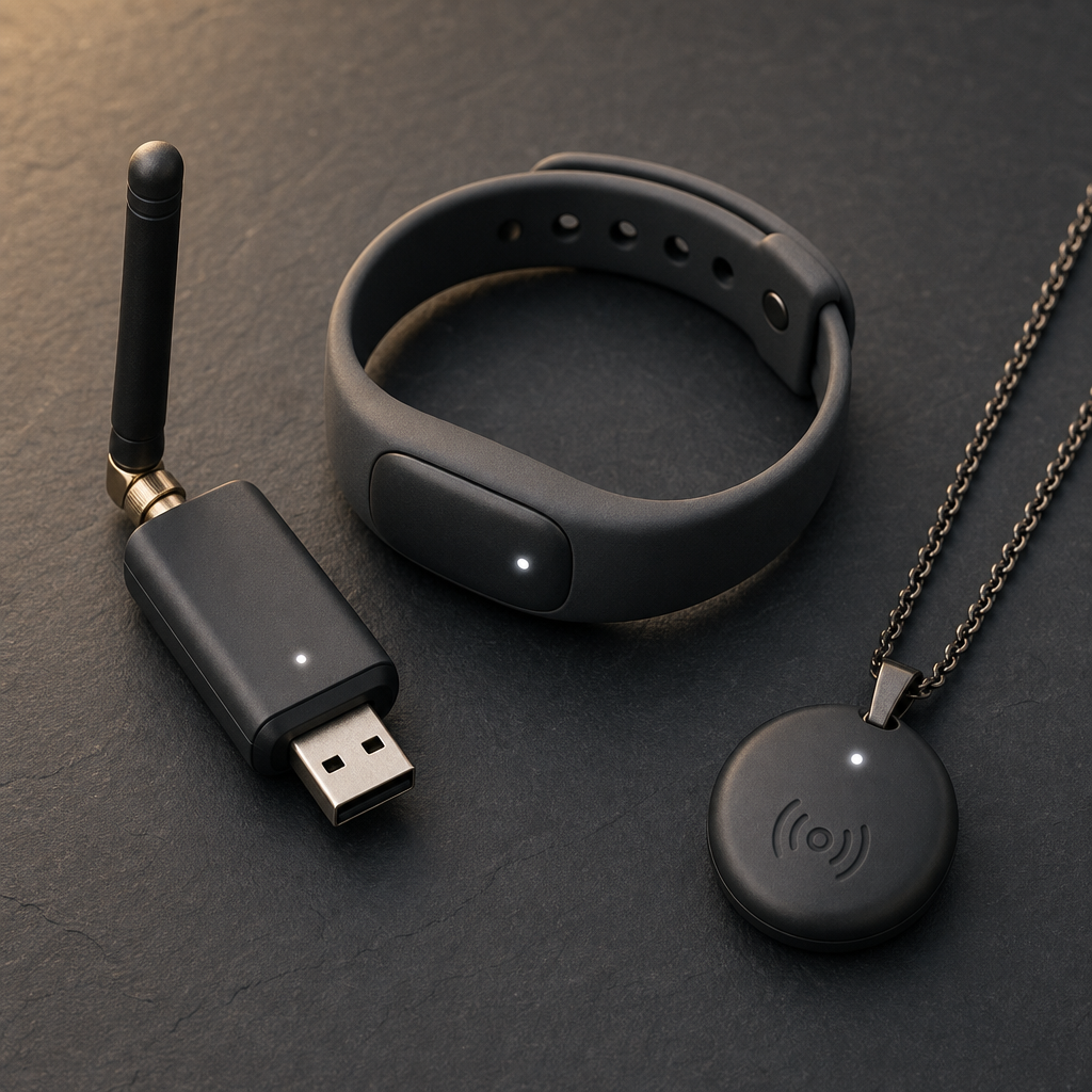
Fig. 7 illustrates the LoRa Safety hardware system and geospatial node platform — for which there is no near-equivalent technology — showing: (A) four patent-pending form factors — USB-style dongle (backpack/belt), tamper-aware silicone bracelet with vibration alert (ages 3–12), discreet SOS pendant for teens, and LoRa Transponder — a fixed dual-role device serving simultaneously as a mesh relay node and child locator base station; (B) dual-mode radio/cellular hybrid operation — normal mode delivers GPS coordinates via cellular/Wi-Fi to the folio-pin app; emergency mode auto-switches to 915MHz LoRa sub-GHz broadcast within 15 seconds of connectivity loss, routing through the mesh and delivering final-hop SMS to the registered parent; (C) signal path: LoRa wearable → mesh node relay chain → last reachable cell node → SMS delivery; (D) geospatial platform architecture — a single verified geographic node network enabling simultaneous applications with no near-equivalent: trade contractor search, food truck live map pins, emergency contractor storm surge, LoRa Safety child location relay, and Folio Pay structured escrow — all sharing the same infrastructure; (E) transponder dual-role: relaying incoming mesh signals while independently operating as a base station receiving wearable pings from the neighborhood. Novel claims: radio-to-SMS mesh bridge for child location, dual-role transponder hardware, tamper-aware wearable with vibration reconnect confirmation, four-form-factor LoRa family on a shared mesh protocol, and the multi-application verified geographic node platform with no near-equivalent geospatial technology.
End of Patent Figures
folio-pin - Geospatial Platform for the Trades
Mapping who built what, where, and when