NGTlink™your Starlink on the ground
Mapping the space we live in, natively at the edge
The Hybrid Radio-Cellphone App: a neighborhood mesh that stays alive when the grid goes dark
Sign up free, drop your pin, and watch the physical safety grid form on the map before any hardware ships. Residents pay $0/mo — own a Baseline Device for $135.
One hybrid app connects every fp Mesh Network: radio when the cell towers are down, cellphone when they are up.
See how the mesh keeps your block connected in an emergency →
Your phone is the first node
When the towers go dark, the smartphone already in your pocket keeps working on the mesh. Drop a free pin and your device becomes part of the neighborhood network tonight — the optional $135 Baseline Device simply extends its reach.
Works without service
No cell signal, no Wi-Fi, no problem. Your phone still sends and receives text on the local mesh when the grid is down.
Hops phone to phone
Messages relay device-to-device over short-range Bluetooth and Wi-Fi Direct, so each neighbor's phone passes the signal a little farther.
Transponder extends range
Add the optional $135 Baseline Device once your zone hits density to bridge phone clusters across the whole neighborhood.
NGTlink™: Your Starlink on the Ground
Mapping the space we live in, natively at the edge
Our 6-Department Municipal Suite does not look up to top-heavy corporate satellite cages. It maps and protects the immediate space we live in, handling Public Safety, Planning, Public Works, Permits, Conservation, and School Transit completely browser-native and 100% offline, straight on the smartphones local families already use every day.
NGTlink stands for Near Geospatial Technology link, the name for the Radio-Cellphone Hybrid App mesh. It connects people to the places and neighbors near them through location-aware, hop-to-hop messaging. A satellite constellation covers the world from overhead. Folio-Pin builds the local version at ground level: phones, wearables, porches, vehicles, and boats pass messages from hop to hop on streets, rivers, and open water, so your coverage comes from the people and vessels around you instead of from orbit.
Overhead constellation
- Nodes
- Satellites in orbit
- Built for
- Wide-area internet access
- You need
- A dish, a clear view of the sky, and a monthly plan
NGTlink ground mesh
- Nodes
- Phones, wearables, home repeaters, and vehicle or vessel transponders
- Built for
- Messaging and locating on streets, rivers, and open water when towers are down
- You need
- The phone you already carry and neighbors in range — $0/mo
Your phone and wearables
The first node. Free to join, and it relays to nearby phones and wearables over Bluetooth and Wi-Fi Direct.
Your porch
The optional $135 Baseline Device bridges phone clusters across the neighborhood.
Your street and waterway
Vehicle and vessel transponders carry the mesh along roads, rivers, and open water as they move.
The NGTlink™ terrestrial constellation
A satellite constellation is many small nodes working as one network. The NGTlink constellation does the same on the ground. The Radio-Cellphone Hybrid App ties together your phone, wearables, transponders, and 900 MHz base stations, so the network still works when the internet is down.
Layer 1: the Radio-Cellphone Hybrid App
The software every other layer plugs into
Internet up
Full map, pins, and messaging over your normal cell or Wi-Fi connection.
Internet down
The same app switches to text over radio. Your phone hands messages to nearby radio hardware, which hops them neighbor to neighbor.
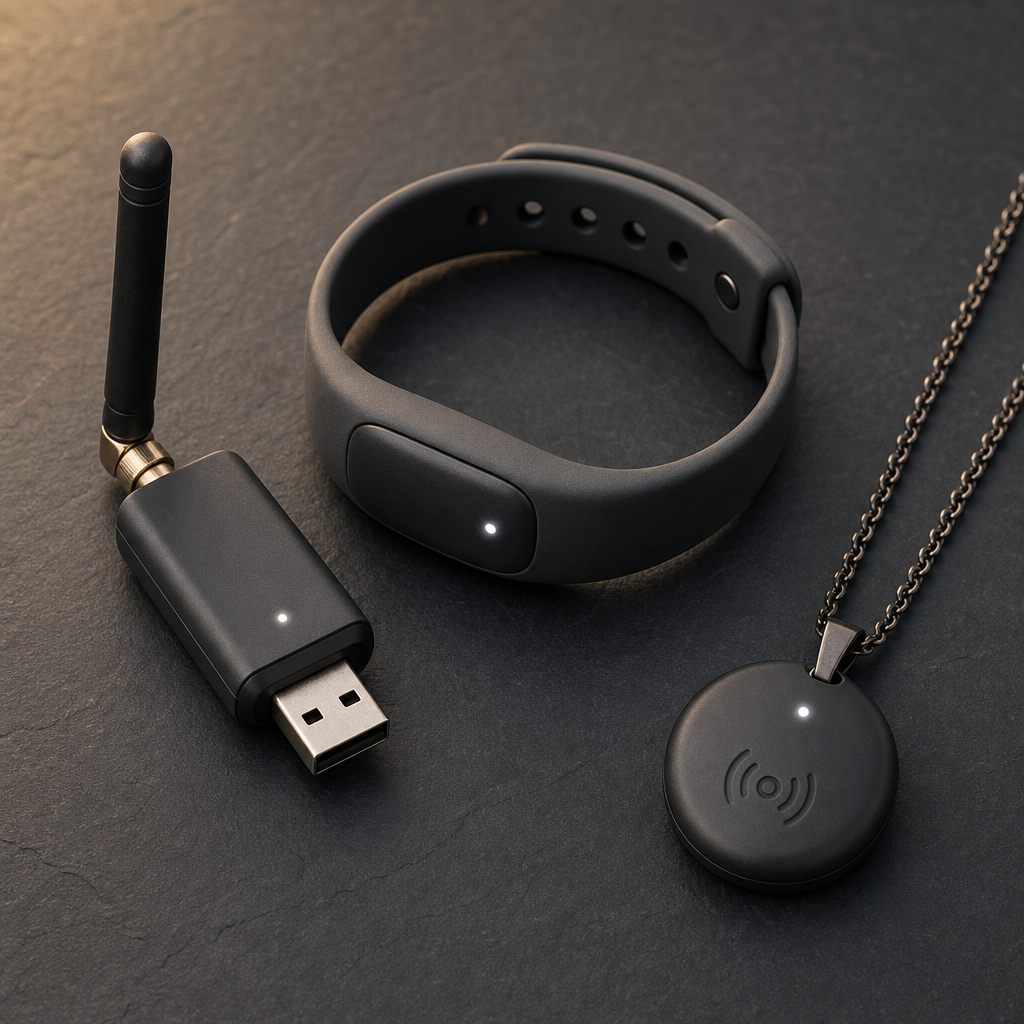
Layer 2: Your personal node
Wearables and dongles
A wristband, pendant, or USB dongle pairs with your phone and carries short text and SOS messages over 900 MHz radio when cell service is gone.
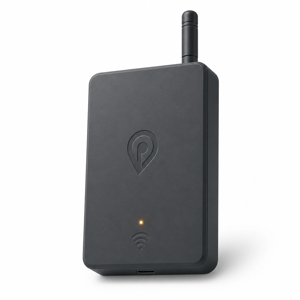
Layer 3: Your porch, vehicle, or boat
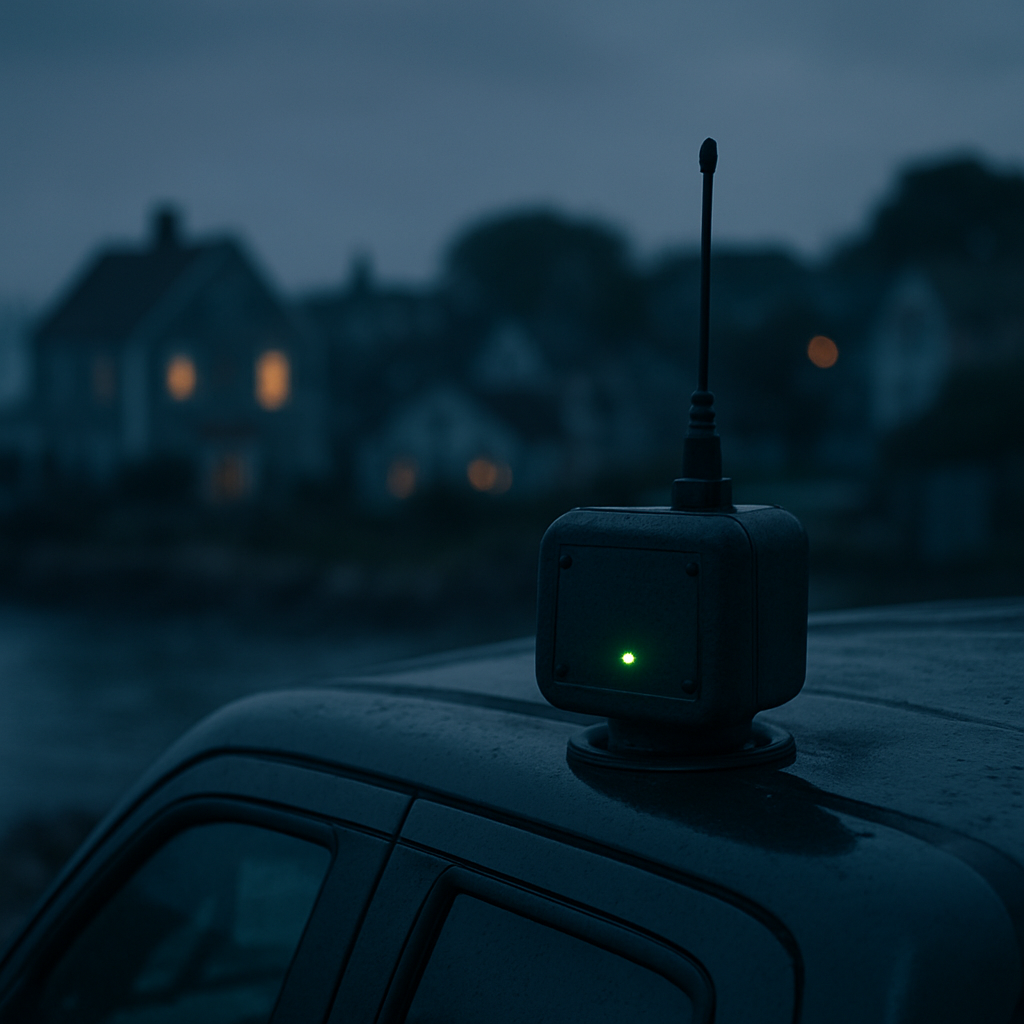
Transponder
A $65 to $130 relay that stays powered and passes messages along streets, rivers, and open water as it moves.
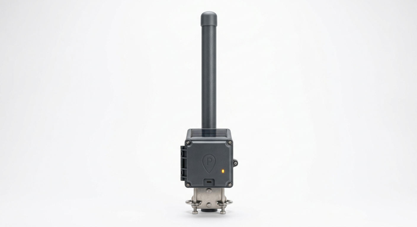
Layer 4: Your township backbone
900 MHz base station
An 8 dBi fiberglass omni antenna with a 1 watt amplifier, built to cover a 10 mile radius, about 314 square miles, over roads and water.
More nodes, more power. A higher number of transponders, wearables, and 900 MHz antennas creates a more powerful terrestrial mesh network. Every node added gives messages another path, widens coverage, and helps the network heal around a failure.
How one message travels with the internet down
- Phone or wearableYou send a text
- TransponderRelays it nearby
- Base stationCarries it miles
- Neighbor's deviceDelivered, no internet
See the full parts list and cost breakdown on the LoRa Safety hardware page.
Framework: Extractive Carrier Cages vs. Open Ground Transit
NGTlink // Open Horizontal Ground Constellation
Operating entirely browser-native as a zero-download Progressive Web Application (PWA), NGTlink interfaces directly with low-overhead, autonomous terrestrial transponder, building, and fleet nodes and with high-power 900 MHz fiberglass omnidirectional base stations. The system bypasses out-of-state telecom monopolies and top-heavy space satellite cartels by deploying a horizontal, self-healing terrestrial data-transit pipeline underneath the cloud layers, across a reliable 10 mile coverage radius.
The Free Internet Allocation Core
Sovereign Allocation Layer
To achieve total grassroots neighborhood adoption and build an unassailable public wall of Prior Art, NGTlink anchors its root-node gateways straight into fixed terrestrial land-line connections, such as local credit unions, municipal offices, or private neighborhood property passports. The high-power base stations ingest this land data and broadcast a local data canopy across up to 314 square miles.
Everyday families and merchants tap straight into this local ground constellation for free, permanently collapsing their monthly carrier data debts, shielding their coordinates from corporate ad-tracking cookies, and keeping communication sovereign and 100% offline-capable during localized cell tower drops or severe winter storm grid failures.
This is a local mesh for messaging and locating, not a replacement for broadband internet. Phase 1 (the digital map) is live now; Phase 2 radio hardware is in the pre-order queue. NGTlink™ (Near Geospatial Technology link) and Folio-Pin™ are unregistered trademarks of Folio-Pin. Starlink is a trademark of SpaceX, and Folio-Pin is not affiliated with it — the comparison describes the shape of the network, not a connection to it.
The Pre-Order Radar
Every free signup lights up a node. Watch the mesh grid form across the Cape and beyond.
Lower Cape Cod
FormingPrecedent for mesh reliability, not a description of our deployment
The National University of Singapore, StarHub, ComfortDelGro Bus, and Veniam ran a vehicular wireless mesh pilot at the Kent Ridge campus: on-board units across a fleet of shuttle buses relayed data hop-to-hop when a bus fell outside a fixed node's range, blending DSRC, LTE, and Wi-Fi to keep connectivity intact — later extended to support outdoor connectivity for seniors and IoT health monitoring. That pilot demonstrates multi-hop mesh relaying holds up under real-world mobility, which is a harder problem than Folio-Pin's largely stationary phone-to-repeater network. It is evidence that the underlying relay approach works in the field, not a claim that Folio-Pin's own mesh has been deployed or validated at that scale.
When the next storm hits, search results change overnight.
Every time a major storm, flood, or hurricane hits a region, homeowners flood Google with searches for roofers, emergency contractors, and disaster response services. The contractors already indexed on folio-pin surface immediately — the ones who signed up after the storm do not.
Pre-indexed, pre-trusted
Folio-pin contractor profiles are already in Google's index with verified location data, permit history, and completed job records. When a homeowner in your town searches 'roof repair after storm' at 11pm, you're already there.
Search volume spikes 10–40×
Local searches for emergency contractors, water damage repair, and tree removal spike sharply in the days after a storm event. folio-pin's verified trade map captures that surge because the data is already structured for local search.
The mesh keeps you reachable
When cell towers go down after a storm, the mesh network keeps neighborhood communication alive — and keeps your contractor listing reachable even when the broader internet is degraded.
What happens in the 48 hours after a storm
Storm hits
Hour 0
Power restored
Hours 2–8
Search surge begins
Hours 4–12
Verified contractors get calls
Hours 6�����24
Marine safety concept
Marine Aquaculture & Fleet Safety
Lobster trap mapping, ropeless gear syncing, and right whale mitigation for the fleet, plus shark detection and deterrent coordination for swimming areas—one unified mesh.
Fleet & Group Packages
From a single wristband to a district-wide fleet — choose the tier that matches how many people you need to protect.
Family & Friends Defense Circle
$499 upfront, one-time
3x long-range transponder nodes + 2x wearable pendants — enough to cover a household and the people you check on most.
How the rollout works
1. Free digital foundation
Residents, artists, and food trucks sign up free and drop pins. Costs you nothing — the cloud maps the exact coordinates of the user base.
2. The hardware waiting queue
Reserve a Window Repeater or Mobile Transponder. The radar lights up with where the grid is forming before any hardware ships.
3. Batch-shipping cadence
When a zone hits critical density (20 residents + 5 food trucks), the cell is authorized and reservations become payable.
4. The Resident Shield
Pay $0 in ongoing fees. Order a Baseline Device for $135. You own the hardware, you own your data, you keep the lifeline alive.
Fee savings that stay local and can fund trade wages.
Payment processing and app-store fees leave town with every sale. If merchants settle through the local mesh and member-owned credit unions instead, part of that cost could stay in the business and become room for higher pay for manual trade labor.
- Mesh transponder installers
- Field maintenance technicians
- Merchant onboarding specialists
- Credit-union integration support
Depends on payment-partner agreements and the merchant fee savings actually being realized.
Directional projection only. No jobs have been counted yet, and no wage or headcount figures are promised.